
August 27, 2026
The Yukon river is the longest free-flowing river in the world while being the world’s longest inland Pacific salmon run (taken from the Yukon River Inter-Tribal Watershed Council). Pretty cool. At the Mile 0 campground in Dawson City, I joked with the manager about paying for a campsite with salmon on my way back; he seemed very open to that.
The Yukon begins in British Columbia and southern Yukon and ends in the Bering Sea on the west coast of Alaska, about 1980 miles. The Bering Sea is part of the northern Pacific Ocean, and separates USA from Russia by way of the Bering Strait, which connects the Pacific Ocean to the Arctic Ocean.
And this is not today’s only geography lesson.
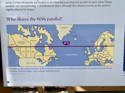
Another nifty fact you may have forgotten from grade-school geography is the location of the 60th parallel, and which other countries share this latitude. And the reason I’m so cold right now. It separates the southern Canadian provinces from the northern, crosses southern Alaska, and crosses Norway, Sweden, Finland, Russia, etc. I am a bit north of it right now, at 63 according to my phone. It was 39 degrees in Tok, AK last night, and Denali has snow in the forecast in a few days.
Nothing that I’m telling you about geography is anything that makes sense to me. As you probably know, I do not have directional sense, and thank god there is only one road for the majority of this trip. I have to park facing the direction I need to go in because I can never remember where I came from. After I camped at Lake Park, with no reception to power my map, I drove up to the highway and had no idea which way to go, being surrounded on all sides by mountains, lakes, rivers, forests. I sat and considered, then turned the wrong way (as I do about 87% of the time). My compass did work this time because I could only be going north or west to get to Alaska, so I U-turned.
Last fact (but probably not). I mentioned some time ago that I spent the night at a borrow pit. I finally googled it today. A borrow pit is an excavated area where material has been dug for use as fill at another location, per Merriam-Webster. Do only rural people and construction workers know what these are? Anyway, a ditch is a borrow pit because the dirt is used to elevate the road. And the large ones, like the pond I camped near, are often filled with water and reclaimed as a wildlife area.
The ever-helpful AI asked if I wanted some examples of a borrow pit from the web, and promptly gave me, “Noah was found dead May 16, a day after he was reported missing, in a borrow pit filled with water near his home in Jesup, Georgia…” Super helpful.
August 29, 2026
Today I am in Denali NP, and wow is it amazing. I can’t see Denali due to cloud cover, but the rest of the mountains are out. So here are some fun Denali facts, as long as there is more name change idiocy happening (Lake Ontario will always be Lake Ontario, imo).
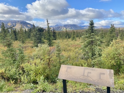
Denali is the highest peak in North America, and it is “Deenaalee” in Koyukon, which means “the high one.” It was called Mt. McKinley in 1896 by a gold prospector (McKinley was president at the time), and adopted by the US in 1917. The name Denali was always used in Alaska, and in 1975 the Alaskan government petitioned for a permanent change. It was denied, of course, because Ohio has always been run by douchebag politicians (birthplace of McKinley).
Along comes Obama, and while he did not change the name, the Secretary of the Interior did before Obama visited in 2015 (over the protests from Ohio). And the name stayed as Denali, until the 2025 inauguration of our pedophile-in-chief, with executive order 14172, changing it back to Mt. McKinley, because, “President McKinley was responsible for creating a vast sum of money.” Yes, he said that.
And how did I get to Denali? Through some pretty horrible roads. I mentioned previously that the frost heave section was not that bad, but that’s only because I hadn’t gone far enough. If you have ever driven the road to Polihale, imagine it worse than the worst it’s ever been. The potholes weren’t too bad, but the washboard was intense. I spent a lot of time driving under 10mph so my furniture wouldn’t shake apart.
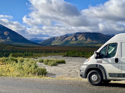
I’m about to drive the Denali Highway (not the road that partly runs through the park), and it is only paved for 24 of its 134 miles. It will probably take me all day, and I’m going to get started since I don’t want to be stuck in the mountains at night.
Have a great day!